
Paris Neighbors Block Sources
There is no confirmed public Paris query that returns every person on a block. The useful public trail is parcel-by-parcel: map the address, identify adjacent parcels, review each appraisal record, and use the deed index for dated title questions. Voter tools are individual or election-file routes, not a block roll. City permit and code material may be available by a focused request, while historical directories and local collections can place a former household at an address for a particular year.
| Source | What It Shows About a Block | Access |
|---|---|---|
| City GIS | Mapped adjacent parcels and streets, plus district, zoning, flood, utility, or other city-layer context | Public map; live selection controls need verification |
| Lamar CAD | Appraisal owner, situs, mailing address, and parcel identifiers for one property | Search each parcel; no visible block or ZIP bulk field |
| County deed index | Recorded transfers for an adjacent legal description | Tyler gateway, clerk, or older film; online cutoff is uncertain |
| Texas voter route | One registration result or election-specific participation information | Individual portal or separate request; protected fields excluded |
| City permit or code material | Possible public address chronology or notice | TPIA or office request; no public address index located |
| Directories and local history | Dated occupant, phone, family, or place context when a source exists | TSLAC, society, library, or archive reference access |
Recorded ownership is not the same as occupancy. A CAD mailing address can be off-block, and a parcel can be held by an entity or representative. The map is a geographic starting point, not a title record. Treat Paris neighbors as a narrow, address-based question and keep each source’s limit visible.
Note: A nearby parcel, a recorded owner, and a current household are different facts that need separate evidence.
Paris Neighbors Start in GIS
The City of Paris GIS City Mapping page documents an address or place search bar, Layers, and a Basemap Gallery. It gives the city geography that CAD does not: streets, water and sewer context, zoning, flood information, and council districts are among the described map layers. Search the target address, confirm the mapped location, and turn on only the layer that answers the geographic question. Record the layer name and map date when the live viewer supplies them.
The City GIS landing page identifies the map controls available before an address is compared with adjacent parcels.
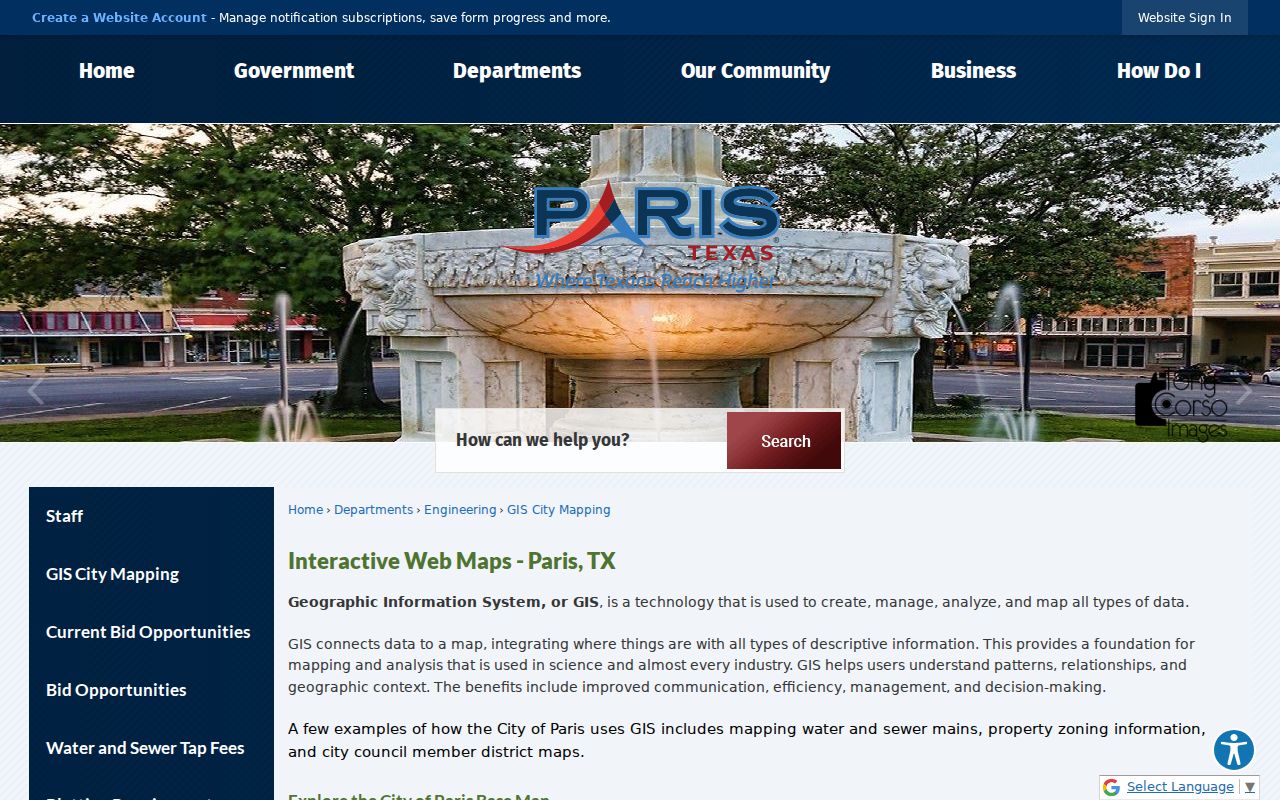
The image reflects the documented starting controls. It does not verify a parcel popup, ownership result, or direct CAD connection.
The separate Paris Engineering maps route adds street, utility, flood-plain, and geography maps. Neither route was verified as a direct ownership system. The research inspection did not confirm a parcel popup, buffer, measure, export, named select tool, or direct link to CAD. Click, pan, zoom, and manual browsing are the supported Paris methods until the live viewer is inspected further.
Open the Paris Engineering map resources before comparing a street with city infrastructure or flood context.

Engineering maps help locate the block and its public layers, but they do not identify a private household or replace a recorded ownership search.
Map Paris Neighbors by Parcel
Use an address-to-parcel flow for the immediate block. This keeps visual proximity separate from a claim of ownership. In the live city viewer, adjacent geometry may be selectable, but that exact behavior was not captured. If it is not selectable, pan across the block and manually match the street number, subdivision, legal description, or geographic ID in CAD. For a whole named street rather than the immediate block, the Paris Street Directory has the broader address chain.
- Search the target address in City GIS, confirm the street and map scale, and switch on an available parcel, land-use, zoning, flood, or district layer.
- Pan or zoom to the immediate block. Inspect adjacent shapes only to record a visible address or map identifier, not to infer an owner from distance.
- Search each recorded address or identifier in Lamar CAD and preserve the situs, mailing address, property or geographic ID, legal description, and selected tax year.
- For a question about ownership timing, take the legal description to the County Clerk deed index and compare the transfer date and party roles.
- When the viewer does not link to CAD, match the records manually and retain the source and date for each parcel.
This process is deliberately narrow. It can establish where public parcel records point, while leaving unlisted household members and protected addresses outside the result.
Paris Neighbors in Lamar CAD
Lamar CAD Property Search has By Owner, By Address, By ID, ARB Search, and Advanced modes. For an address, use the street number and a street name without prefix, suffix, or unit number. The portal suggests a simple street-name search when formatting fails. Its visible advanced controls include property and geographic IDs, subdivision, neighborhood, property type, and a 2017 through 2026 tax-year selector. There is no visible ZIP field, so it cannot serve as a one-click list for a block or postal area.
Save the identifier, legal description, and the distinction between situs and mailing address. Situs means the physical parcel location. The mailing address is where tax notices are sent. A nonmatching mailing address may belong to an owner receiving mail elsewhere, an entity, a representative, or a prior address. An exemption is an appraisal clue for a stated period, not evidence that a particular person is present now.
The Lamar CAD search interface below shows the property-search modes used to match one mapped parcel at a time.
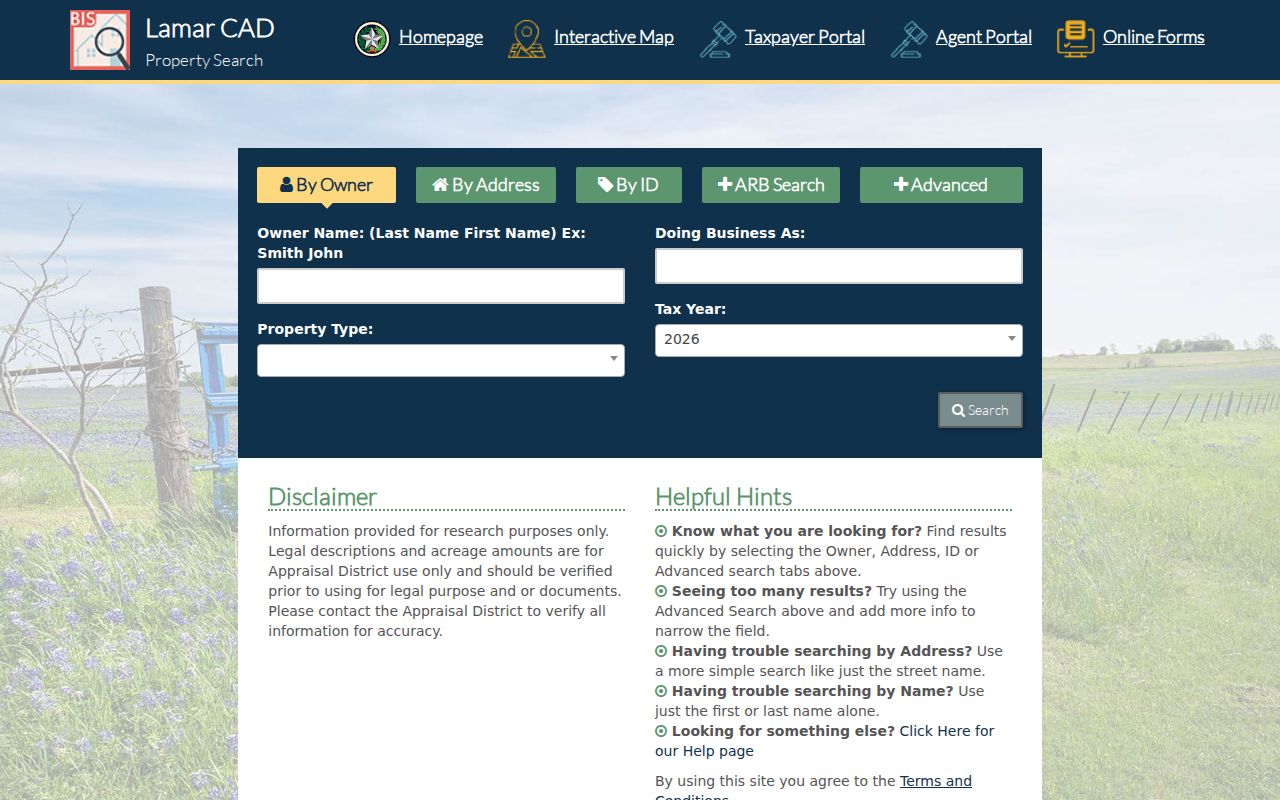
The portal connects an address or parcel key to appraisal data. It does not provide a census of Paris neighbors or prove that the recorded owner occupies the situs.
Paris Neighbors and Deed Dates
When the question is who held recorded title at a particular time, move from CAD to the Lamar County Clerk land-record route. Search the current owner as grantee, find the vesting instrument, record its seller or grantor and legal description, then search the seller as grantee in an earlier transfer. A grantor is the party transferring an interest; a grantee is the party receiving it. The legal description, lot and block, or geographic ID is a more stable bridge than a modern street address.
The online Tyler land-record cutoff is described inconsistently in local materials as starting in 1960 or 1971. The safe Paris instruction is to verify the cutoff with the clerk. Older deed books, indexes, and microfilm are available through the County Clerk, Texas State Library and Archives, and some digitized routes. The public index is a research aid, not a certified copy. Use the clerk for a complete or certified record and search spelling, initial, married-name, and entity variants.
Note: A deed establishes a recorded property interest and date, not the identity of everyone who may have lived near or on the parcel.
Paris Neighbors and Voter Limits
The Texas My Voter Portal searches an individual registration record through a VUID, state identification route, or a name, county, date-of-birth, and ZIP combination described by SOS guidance. It is not a block search. Lamar Elections also links election-specific “Voters Who’ve Voted” files, including files observed for 2023 through 2026. Participation in a named election does not reveal a ballot choice and does not prove that a person currently lives at an address.
A full voter-list request is a separate SOS or county process with active, suspense, and cancelled choices, delivery formats, confidentiality rules, and possible fees. Mailing or residence information can be protected. Texas Address Confidentiality Program participants and eligible protected voters have special handling, and SSN, driver-license, and personal-ID information are confidential. Use an individual record only for its election-administration purpose, then return to the parcel and clerk records for address history.
| Official source | Compiled neighbor tool |
|---|---|
| Identifies a source, date, field limits, and responsible custodian. | May combine older public, licensed, or supplied information with uncertain matching and refresh timing. |
| CAD records appraisal ownership; GIS records map context; a deed records a transfer. | A compiled profile does not replace a parcel card, clerk document, or protected-record rule. |
| Correction or copy questions go to the original office. | Removal requests do not change the underlying government record. |
Paris Neighbors Address Requests
Paris Engineering, building, Code Enforcement, and Municipal Court can hold different pieces of address history. No public Paris address index for permit or code results was confirmed in the research. Start with a specific street number, street name, date range, and record type. The City of Paris Texas Public Information Act route accepts online, paper, and email requests. Ask for a permit application, issue or final inspection, alteration description, code notice, case disposition, or the public fields relevant to the request.
A complaint form is not the same as a released file, and a municipal case can have a different number and custodian from a code record. The Texas Public Information Act, Texas Government Code Chapter 552, is the general access route for non-exempt city or county records. A request may still yield redactions, exemptions, copying costs, or a separate clerk response. Give the office a record identifier when one is known.
Paris Neighbors Civic Context
No authoritative current Paris neighborhood-association or HOA directory with named associations and member rosters was verified. That gap matters. City GIS and council-district layers provide official geography and city contacts, but they do not publish a private household roster. A voluntary neighborhood directory, if one exists, is not an official resident roll and should be used only through a published organizational contact.
The documented public and reference routes below can help with geography, parcel history, or historical community context. They are not substitutes for a current neighborhood roster.
City GIS City Mapping
Address/place search, Layers, and Basemap Gallery for mapped Paris context.
Lamar CAD
Parcel-by-parcel appraisal owner, situs, mailing, and identifier research.
Lamar County Clerk
Recorded instruments, older books, and certification for the deed chain.
Local History Resources
Genealogical and historical collections offer dated community context, not current member lists.
The Lamar County Historical Society, Genealogical Society, city boards and commissions, and historical church or civic materials can supply family and neighborhood context. Membership or contact lists were not confirmed as public. Request only an organization’s published contact and do not infer affiliation or residence from a historical mention.
Paris Neighbors Privacy Limits
Property records do not list every renter, household member, utility customer, delivery recipient, or person staying at an address. Protected voters and Address Confidentiality Program participants can have actual addresses suppressed or handled through confidential processes. Ballot choices, DMV addresses, and confidential identity numbers are not block-search fields. A no-result can reflect a format problem, date, jurisdiction, protection, or an offline record, not an invitation to reconstruct private information.
Lawful use. Use Paris neighbors records for personal, lawful research and civic understanding. Never use an address, map, or public record to stalk, harass, intimidate, or harm another person.
For historical questions, Paris directory volumes, deeds, census schedules, newspaper notices, cemetery entries, and probate can create a dated trail. They still need careful reading. A directory is a snapshot, a deed is a title record, and an obituary or probate file records a past event. Keep a source date with every conclusion and leave protected or unlisted households out of the result.