
Paris ZIP Code Coverage at a Glance
Three ZIP codes are confirmed for Paris: 75460, 75461, and 75462. They describe delivery patterns, not three municipal districts or parcel maps. The coverage wording below stays deliberately limited to what the official research established. USPS assigns the exact delivery result by address, and no official Paris neighborhood-by-ZIP narrative or public ZIP boundary layer was located.
| ZIP | Areas Covered | Post Office | Notes |
|---|---|---|---|
| 75460 | Standard Paris delivery associated with central or main Paris addresses and portions of the city delivery area | Exact address result should be checked with USPS | Not identical to Paris city limits or a Lamar CAD search area. |
| 75461 | Paris postal, PO-box, and legacy station use | Park Place station was discontinued; the ZIP was retained | Do not assume ordinary street delivery or a separate neighborhood. |
| 75462 | Standard Paris delivery for portions of Paris and the surrounding delivery area | USPS assigns exact address ranges | A 2006 notice moved 287 deliveries to 75460; it did not erase 75462. |
The USPS DMM label list and a Texas government postal list identify these ZIPs with Paris, but neither source is a city-limit or parcel-boundary map. A Paris ZIP code directory is therefore an address-normalization tool, not a map of who lives within an incorporated boundary.
Verify a Paris ZIP Code by Address
USPS ZIP Code Lookup guidance directs users to validate a complete address and use the standardized result. That exact-address step is the most reliable postal check. A city name beside a ZIP does not prove that the point lies inside the City of Paris, and a ZIP alone does not establish ownership, municipal services, a precinct, or a household. Retain the standardized street form with the result, especially when comparing older directories or letters.
The live USPS experience is dynamic, and the research did not capture a stable field-by-field form inventory. It would be unsafe to invent required fields, a current button label, or a ZIP-boundary function. Use the official lookup for the exact address, then move to the street and parcel systems that have documented local search modes.
Start with the USPS ZIP Code Lookup guidance before standardizing a Paris address.
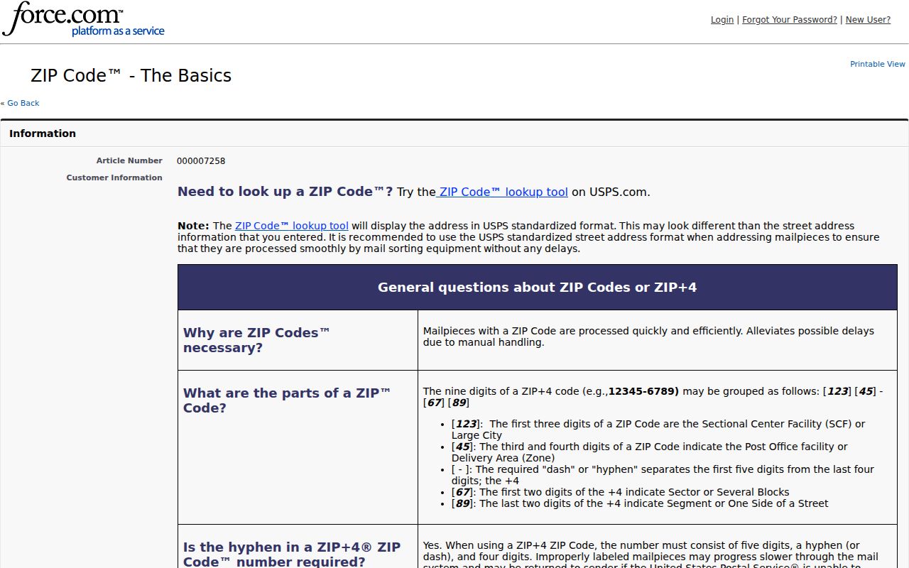
The USPS guidance supports an exact-address check, rather than a ZIP-only conclusion about Paris geography.
Paris ZIP Code History at 75461
The 2011 USPS Postal Bulletin reports that Park Place station was discontinued on February 19, 2011 while ZIP 75461 was retained. That is a useful historical bridge when an old directory, envelope, or record uses a station name with 75461. It does not establish that the ZIP marks a current staffed station, an ordinary street-delivery area, or a distinct Paris neighborhood.
Preserve both the ZIP and the date when transcribing a historical address. The retained ZIP is a postal-history clue. It should be paired with the printed street form, a city directory date, a deed description, or a map rather than converted into a present-day boundary claim.
Note: A retained ZIP can explain an older address form without establishing a current delivery pattern for every address that uses it.
Move from a Paris ZIP to Records
Paris systems do not offer one verified directory of every person in a ZIP. Instead, use a postal result to locate a street address, then connect that address to local records. Lamar CAD has street and identifier searches, City GIS has address or place search and map layers, and the County Clerk relies on parties and legal descriptions. This chain respects the different geography each system uses.
- Confirm the complete street address with USPS and save the returned city, state, ZIP, and standardized street form.
- Search Lamar CAD by street number and street name. Save the situs and mailing address, property or geographic ID, legal description, subdivision, and tax year.
- Open Paris City GIS and check the address or place in the mapped street, district, zoning, utility, or flood context that the layers provide.
- Use the Clerk's land-record route by owner or legal description when a recorded transfer matters; a deed may carry a mailing address in a different ZIP from the situs.
- For a named person only, use the county and ZIP as a locator in My Voter Portal. Do not treat that route as a ZIP-wide roster.
Once the ZIP has narrowed an address, the Paris street directory gives the fuller address-by-address workflow. A parcel result may identify an owner or tax mailing address, not every person at the location.
Paris ZIP Code Searches Stop at CAD
Lamar CAD Property Search has By Owner, By Address, By ID, ARB Search, and Advanced modes. Its visible address fields are Street Number and Street Name, with the instruction to omit prefixes, suffixes, and unit numbers. Advanced choices include owner, property and geographic identifiers, subdivision, neighborhood, property type, and tax year. No ZIP field was visible in the captured interface. That limitation is why a Paris ZIP code directory search must become an address search before it becomes a parcel search.
| Local system | Verified search key | ZIP role | Result limit |
|---|---|---|---|
| USPS ZIP Lookup | Exact address and standardized result | Postal validation | Dynamic fields were not captured; it is not a parcel boundary tool. |
| Lamar CAD | Street number, street name, owner, property ID, geographic ID | No visible ZIP filter | Appraisal and parcel information, not a household list. |
| City GIS | Address or place search, Layers, Basemap Gallery | No verified ZIP search or boundary tool | Map context, not title or postal proof. |
| County deed index | Parties and legal description | Not a ZIP-keyed search | A mailing address can differ from the parcel situs. |
The CAD search screen's tax-year selector visibly reaches 2017 through 2026. Those selected appraisal years should not be presented as a complete record of older Paris property history.
Review the Lamar CAD search screen to see the documented address and identifier modes.
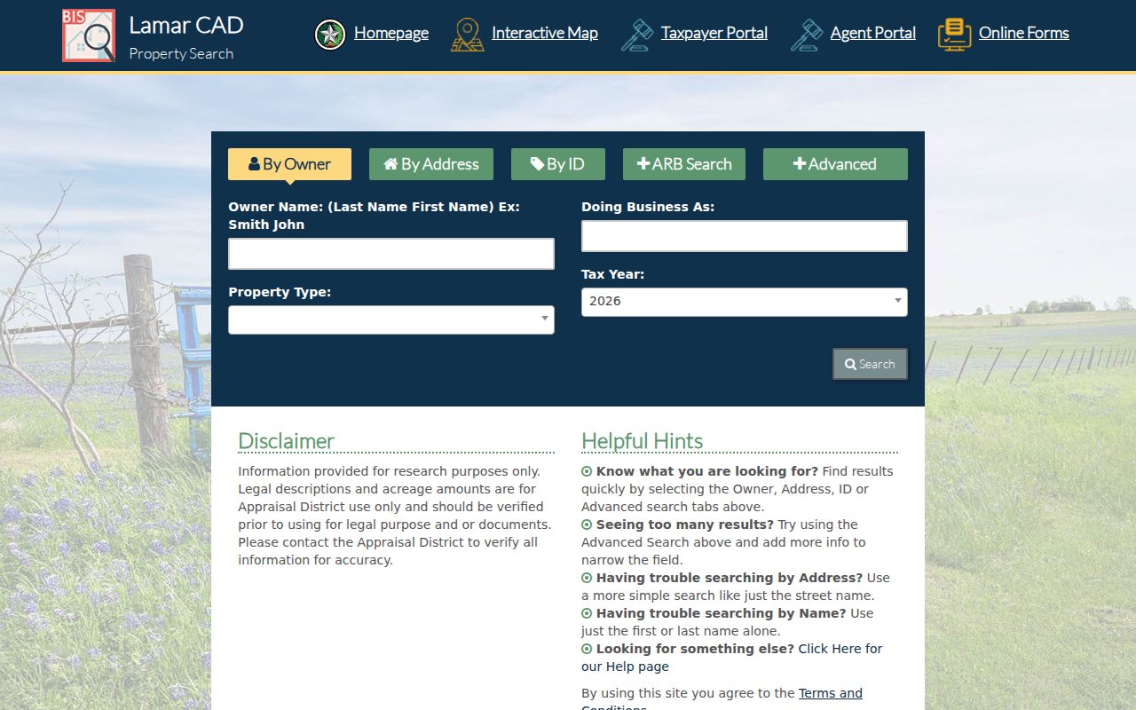
The CAD interface confirms several address and parcel keys but no visible ZIP field for a broad Paris ZIP search.
Map Paris ZIP Addresses to Parcels
Paris City GIS uses an address or place search bar and exposes Layers and a Basemap Gallery. The city identifies layers for streets, water and sewer mains, zoning, and city-council districts. Paris Engineering also provides street, utility, flood-plain, and geography maps. After USPS standardizes an address and CAD identifies the parcel, GIS can show its local context.
The captured city material did not verify a ZIP boundary layer, buffer control, export control, or direct link from a mapped shape to a CAD owner record. Pan and inspect the documented address/place and layer tools manually. A GIS result helps decide whether a location is in a named city layer, but it cannot turn a postal ZIP into an incorporated-boundary conclusion.
Use City GIS mapping after the postal and parcel steps are complete.

The map instructions provide the documented tools for placing a Paris ZIP address in city-layer context.
Use ZIP as a Paris Voter Locator
Texas My Voter Portal can use ZIP as part of the individual name route described by Secretary of State guidance. It is not an every-person search for a Paris ZIP. The live application is dynamic, so its exact current required markers and button labels were not verified. The documented fields below describe the research route without claiming a public ZIP roster.
| Documented field or route | Type | Use and limitation |
|---|---|---|
| First name and last name | Text | Name route, entered as shown on registration. |
| Date of birth | Date | Paired identity check; not an unrestricted result field. |
| County | Selection or search | Select Lamar for a Paris-area registration route. |
| ZIP code | Text | Additional locator in the name route; exact current requirement is unverified. |
| VUID or state ID route | Text | Individual lookup alternatives, with identity checks. |
Lamar Elections posts voter-participation files for named elections. They are date-specific, do not disclose ballot choices, and should not be converted into a general ZIP directory. Protected-voter and address-confidentiality rules can also limit display.
Read Older Paris ZIP Codes in Context
The 2006 Postal Bulletin directed 287 deliveries previously in 75462 to use Paris, TX 75460 as the last line. That change is a narrow historical clue, not proof that all 75462 addresses vanished. A pre-2006 record can need a postal-era bridge before its street address is matched to CAD, GIS, or a later directory.
For older address work, compare the printed ZIP and date with a city directory year, census, deed, Sanborn map, or newspaper. County deeds rely on parties and legal descriptions, and older records may be available through the Clerk, TSLAC's Lamar County holdings, or other documented reference collections. The durable connection is the legal description or dated street form, not the ZIP alone.
Paris ZIP Codes Are Not City Limits
A Paris mailing address can be outside the incorporated city, while a city-limit service, municipal court matter, or code record depends on jurisdiction. ZIPs 75460 and 75462 can serve locations beyond city limits, and a Paris last line can identify a delivery route rather than municipal residency. Confirm city context in GIS and parcel context in CAD. Never use a ZIP alone to infer a neighborhood, precinct, city-limit status, ownership, or household.
- ZIP code and ZIP+4
- A ZIP identifies a postal delivery area. ZIP+4 adds a more specific delivery segment; neither replaces a parcel or city-boundary record.
- PO-box ZIP
- A ZIP used for post-office-box delivery. It does not prove that a corresponding street address receives ordinary delivery.
- Unique ZIP
- A ZIP assigned to a single organization or destination. No such Paris example was established in the research.
- Carrier route
- A delivery sequence used by postal operations, not a city district, ownership roll, or household directory.
If a city record is needed, use the standardized address with the relevant Paris or Lamar County custodian and confirm the jurisdiction in GIS. Postal geography alone does not select the proper office.
Careful use. Postal and parcel records can support lawful personal research, family history, or property questions. Do not use them to stalk, harass, intimidate, or harm any person.